Tuesday, May 17, 2011

Manipur


Manipur
মণিপুর
—  State  —

Seal
Location of Manipur in India
Map of Manipur
Coordinates (Imphal): 24.817°N 93.95°E
Country India
Established21 January 1972
CapitalImphal
Largest cityImphal
Districts9
Government
 - GovernorGurbachan Jagat
 - Chief MinisterOkram Ibobi Singh
 - LegislatureUnicameral (60 seats)
Area
 - Total22,347 km2 (8,628.2 sq mi)
Area rank23rd
Population (2011)
 - Total2,721,756
 - Rank22nd
 - Density121.8/km2 (315.4/sq mi)
Time zoneIST (UTC+05:30)
ISO 3166 codeIN-MN
HDIincrease 0.707 (medium)
HDI rank5th (2005)
Literacy79.85% (2011 Census)
Official languagesMeiteilon
WebsiteManipur Official Website
Manipur  (Meitei: মণিপুর maṇipur) is a state in northeastern India, with the city of Imphal as its capital. Manipur is bounded by the Indian states of Nagaland to the north, Mizoram to the south and Assam to the west; it also borders Myanmar to the east. It covers an area of 22,347 square kilometres (8,628 sq mi). Geographically, it falls under the Southeast Asia region.
The Meiteis (Meeteis), who live primarily in the state's valley region, form the primary ethnic group. Their language, Meiteilon (Meeteilon), (also known as Manipuri), is also the lingua franca in the state, and was recognized as one of the national languages of India in 1992. The Muslims (Meitei-Pangal) also live in the valley; the Kukis, Nagas and Hmars live in the hills of the state. Manipur is considered a sensitive border state.
Foreigners entering Manipur (including foreign citizens born in Manipur) must possess a Restricted Area Permit, which can be obtained from the Foreigners' Regional Registration Office in the "metros" (Delhi, Mumbai, Kolkata, Chennai) or certain other state government offices. Permits are valid for only 10 days, and visitors must travel only on tours arranged by authorised travel agents, in groups of four. Furthermore, they may come to Imphal only by air and are not permitted to travel outside the capital.

History


The Kangla Sha, the state emblem
The Kangla Gate (west entrance to theKangla Fort
Manipur came under British rule as a princely state in 1891 and existed until 1947, when it acceded to the newly independent Union of India. During the Second World War, Manipur was the scene of many fierce battles between the Japanese and the Allied forces. The Japanese were beaten back before they could enter Imphal, and this proved to be one of the turning points of the war. After the War, the Manipur Constitution Act of 1947 established a democratic form of government with the Maharaja as the Executive Head and an elected legislature. In 1949, Maharaja Budhachandra was summoned to Shillong, capital of the then Indian province of Assam. The legislative assembly was dissolved on the controversial annexation of the state with the republic of India in October 1949. Manipur was a union territory from 1956 and later became a full-fledged state in 1972.
Manipur became a Union Territory in 1956 and later, in 1972, a full-fledged state of India with Muhammad Alimuddin becoming the first statehood Chief Minister (1972–74).
There has been a separatist movement in Manipur since 1964 with the establishment of United National Liberation Front, with several violent groups desirous of a sovereign Manipur. Special permission must also be obtained for those who wish to enter Manipur, as it is considered a "sensitive area" on account of its political troubles and geographical location.

Geography, vegetation and climate


Geography

Singda-The place where the Highest Mud Dam in India is located
Barak River in its upper course in Manipur
Manipur is one of the seven states of Northeast India, and one of the Seven Sister States. The state is bounded by Nagaland in the north, by Mizoram in the south, by Assam in the west, and by the borders of the country Myanmar in the east as well as in the south. The state capital of Manipur is Imphal. The state lies at latitude of 23°83’N – 25°68’N and longitude of 93°03’E – 94°78’E. The total area covered by the state is 22,347 km². The capital lies in an oval-shaped valley of approximately 700 square miles (2,000 km2) surrounded by blue mountains and is at an elevation of 790 metres above the sea level. The slope of the valley is from north to south. The presence of the mountain ranges not only prevents the cold winds from the north from reaching the valley but also acts as a barrier to the cyclonic storms originating from the Bay of Bengal.
There are four major river basins in Manipur State, the Barak River Basin (Barak Valley) to the west, the Manipur River Basin in central Manipur, the Yu River Basin in the east, and a portion of the Lanye River Basin in the north. The total water resources of Barak and Manipur river basins are about 1.8487 Mham. The overall water balance of the state amounts to 0.7236 Mham in the annual water budget. (By way of comparison, India receives 400 Mham (million hectare meters) of rain annually) TheBarak river, the largest river of Manipur, originates in the Manipur Hills and is joined by a number of tributaries such as the IrangMaku, and Tuivai. After its junction with the Tuivai, the Barak River turns north and forms the border with Assam State, and then enters the Cachar Assam just above Lakhipur. The Manipur river basin has eight major rivers: the ManipurImphalIrilNambulSekmaiChakpiThoubal and Khuga. All these rivers originate from the surrounding hills.
Almost all the rivers in the valley area are in the mature stage and, therefore, deposit their sediment load in the Loktak lake. The rivers draining the Manipur Hills are comparatively young, due to the hilly terrain through which they flow. These rivers are corrosive in nature and assume turbulent form in the rainy season. Important rivers draining the western area include the Maku, Barak, Jiri, Irang and Leimatak. Rivers draining the eastern part of the state, the Yu River Basin, include the Chamu, Khunou and other short streams.
Physiographically, Manipur may be characterised in two distinct physical regions – an outlying area of rugged hills and narrow valleys, and the inner area of flat plain, with all associated land forms. These two areas are not only distinct in respect of physical features but are also conspicuous with regard to various flora and fauna. The valley region would have been a monotonous, featureless plain but for a number of hills and mounds rising above the flat surface. The Loktak lake is an important feature of the central plain. The total area occupied by all the lakes is about 600 km². The altitude ranges from 40 m at Jiribam to 2,994 m at Mt. Iso Peak near Mao Songsong.
The soil cover can be divided into two broad types, viz. the red ferruginous soil in the hill area and the alluvium in the valley. The valley soils generally contain loam, small rock fragments, sand and sandy clay, and are quite varied. On the plains, especially flood plains and deltas, the soil is quite thick. The top soil on the steep slopes is very thin. Soil on the steep hill slopes is subject to high erosion, resulting in gullies and barren rock slopes. The normal pH value ranges from 5.4 to 6.8. The climate of the State is salubrious with approximate average annual rainfall varying from 933 mm at Imphal to 2593 mm at Tamenglong. The temperature ranges from sub-zero to 36°C.


Districts

Manipur has currently nine administrative districts.
District↓Area↓Population↓Headquarters↓
Bishnupur496208,368Bishnupur
Churachandpur4570227,905Churachandpur
Chandel3313118,327Chandel
Imphal East709394,876Porompat
Imphal West519444,382Lamphelpat
Senapati3271283,621Senapati
Tamenglong4391111,499Tamenglong
Thoubal514364,140Thoubal
Ukhrul4544140,778Ukhrul


Vegetation

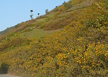
Flowers lining up the Foothills
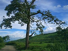
A tree standing alone amidst the wilderness
The natural vegetation occupies an area of about 14,365 km² which is nearly 64% of the total geographical area of the state. The vegetation consists of a large variety of plants ranging from short and tall grasses, reeds and bamboos to trees of various species. Broadly, there are four types of forests:
  • Tropical Semi-evergreen.
  • Dry Temperate Forest
  • Sub-Tropical Pine
  • Tropical Moist Deciduous
Teak, pine, oak, uningthou, leihao, bamboo, cane, etc. are important forest resources growing in plenty. In addition, rubber, tea,coffee, orange, and cardamom are grown in hill areas. Rice is a staple food for Manipuris. Rice and cash crops make up the main vegetation cover in the valley.


Climate

The Dzuko Valley lying on the border of Manipur and Nagaland has a temperate climate
Monsoon clouds in Manipur
The climate of Manipur is largely influenced by the topography of this hilly region which defines the geography of Manipur. Lying 790 meters above sea level, Manipur is wedged between hills on all sides. This northeastern corner of India enjoys a generally amiable climate, though the winters can be a little chilly. The maximum temperature in the summer months is 32 degree C. In winter the temperature often falls below zero, bringing frost. Snow sometimes falls in some hilly regions due to the Western Disturbance. The coldest month is January, and the warmest July. The ideal time for tourism in the state, in terms of climate, is from October to February, when the weather remains bright and sunny without the sun being too hot.
The state is drenched in rains from May until mid-October. It receives an average annual rainfall of 1467.5 mm. However, the rain distribution varies from 933 mm in Imphal to 2593 mm in Tamenglong. The precipitation ranges from light drizzles to heavy downpour. The normal rainfall of Manipur enriches the soil and helps in agricultural processes and irrigation. The South WesterlyMonsoon picks up moisture from the Bay of Bengal and heads toward Manipur, hits the eastern Himalaya ranges and produces a massive amount of rain in the state.

Population

Manipur has a population of 2,388,634. Of this total, 58.9% live in the valley and the remaining 41.1% in the hilly region. The hills are inhabited mainly by the Nagas, Kukis (Chin-Mizos) and smaller tribal communities and the valley mainly by the Meiteis, Pangal, and "Bhamons" who are literally non-Meiteis). Some Naga,Kuki and Hmar settlements are also found in the valley region. Racially, Manipuri people are far more similar to Southeast Asians than to mainland Indians. The distribution of area, population and density, literacy rate, etc. as per the 2001 Census provisional figures are as below:

Language


The official languages of the state are Manipuri and English.


Manipuri language (Meiteilon)

Meiteilon, the official language of Manipur, has a long history. Courses on Manipuri Language and Literature are offered as a subject up to M.A. level in both Central and State Universities. It is the main language of communication among all different tribes and people inhabiting Manipur. English is also slowly gaining ground as a common language of communication.Hindi is also in use by the migrants from northern India. Meitei has been recognized as the Manipuri language by the Indian Union and has been included in the list of scheduled languages (included in the 8th schedule by the 71st amendment of the constitution in 1992). Meitei is taught as a subject up to postgraduate level (Ph.D.) in Indian universities, apart from being a medium of instruction up to the undergraduate level in Manipur.


Meitei Mayek (Manipuri script)

Meitei Mayek is a script, commonly referred as Mayek, which has been used since ancient times. Though out of vogue for a certain period, in the recent past it has gained popularity.


Languages of hill people

There are 29 different dialects spoken in Manipur. Six main hill dialects recognised by Government of Manipur for medium of instruction & examination up to class XII are :
  1. Thadou-Kuki, dialect of Kuki people, the second language in the state after Meiteilon during Colonial Period.
  2. Tangkhul, dialect of Tangkhul people
  3. Hmar, dialect of Hmar people
  4. Paite, dialect of Paite people
  5. Mao, dialect of Mao People
  6. Rongmei dialect of Rongmei people

Transportation


Tulihal Airport, the airport of Imphal, connects the state capital with Delhi, Kolkata Guwahati and Agartala. National Highway NH-39 links Manipur with the rest of the country through the railway stations at Dimapur in Nagaland at a distance of 215 km (134 mi) from Imphal. National Highway 53 (India) connects Manipur with another railway station at Silchar in Assam, which is 269 km (167 mi) away from Imphal. The road network of Manipur, with a length of 7,170 km (4,460 mi) connects all the important towns and distant villages.
On April 9, 2010, Union Minister of India, Shashi Tharoor announced that the central government is considering a rail link from Manipur to Vietnam.

Religion


Pakhangba


Hinduism and Sanamahi


The people of Manipur follow several faiths and religions which can be traced down to its unique historical past. Sanamahism is an ancient indigenous religion, rich in mythology and colorful in ritual. The Sanamahi worship is concentrated around the Sun God/Sanamahi. Early Manipuris were the devotees of a Supreme deity "Lainingthou Soralel" following the footprint of their Godly ancestors. That particular kind of ancestor worship and animism, with the central focus of worship on Umang Lai – that is, ethnic governing deities worshipped in sacred groves. Some of the gods(Lais) Manipuris worship are Atiya Sidaba, Pakhangba, Sanamahi, Leimaren, Oknarel, Panganba,Thangjing, Marjing, Wangbaren, Koubru. The religious life of the people, even when they adopted non-mainstream Hinduism, retained many characteristics inherited from their prehistoric ancestors. The essentials of this religion remain recognizable to the present day. Hinduism has an ancient presence in Manipur, but did not win widespread adoption until relative recent history. It was in the 15th century that a particular form of Vaisnavism was adopted and spread under the reign of King Kyambathrough to King Khagemba in the 19th century. Towards the end of the 19th century and at the advent of the 20th century, a great force of Gaudiya Vaishnavism came and spread in Manipur. Over the last couple of decades there has been a revival of Sanamahi religion and this was evident in the significant growth of the "non-mainstream" religion category in the 2001 census which amounted to 17% of the population. Due to the revival of demographic profile of the state, Sanamahism will now be included in the next Government of India population census in 2011. According to the 2001 census Hinduism is identified with 47% of the population.


Christianity

St.Joseph's Cathedral at Imphal
Christianity in Manipur started to spread in the 19th century onwards by missionaries. The 20th century saw the establishment of a few Christian schools which then introduced Western-type education in this remote part of the world. Some of the finest schools in Manipur are Little Flower School in Imphal, Don Bosco High School in Imphal, St. Joseph's Convent, Nirmalabas High School.

 These schools have produced achievers in various professions such as medicine, engineering, and other branches of science. A sizeable Meitei population have joined Christianity. Christianity constitutes 34% of the population.


Islam

Muslims numbering 190,939 form about 8.32% of the state population as per 2001 census. Influence of religious preceptors- Shaikh Shah Jalal Yemeni who came to Sylhet in 1303 AD and Azan Fakir Baghdadi in 1690 AD in Assam is also felt among Manipuri Muslims. There are Arab, Turani, Bengali and Mughal or Chaghtai Turk sections among Manipuri Muslims.